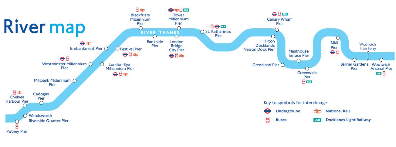
River Thames Transport Map
Navigating the River Thames can be confusing, with piers, underground stations, busses, national rail and docklands light railway services to take into accout. The map below simpy shows the location of these five elements in relation to the River Thames, so you can see simply where everything is located and how to navigate to each pier.
Reviews
Great day- thank you to you and your team!
Have had some lovely comments on the food quality, how well the day was run, we are looking forward to booking with you again.
Thank you!


